Judy –12/16/10 After a few days in Allen Cays, we departed for Shroud Cay in the Exuma Land and Sea Park. We soon picked up a hitchhiker. A small seabird, possibly a tern, landed on the solar panel and hung out for a while, turning it into a literal poop deck. As we got out onto the Exuma Banks west of Allen Cay, we decided to swing the compass for the autopilot. After a fashion we got it done. The instruction book is a little different than the model of the controller we have, so it took lots of button pushing to get to the correct place. We then had a wonderful mostly hands free sail/motor-sail to Shroud Cay, our first stop in the ECLSP. A Bahamas National Park, Exumas Cays Land and Sea Park is the first land and sea park in the world and covers 176 square miles. It is 22 miles long and 8 miles wide, covering into the ocean (Exuma Sound) and Exuma Banks and includes numerous small and larger cays, some public and some privately owned. There are hiking trails, snorkeling areas with coral reefs and pristine beaches.
Looks like the internet is having trouble uploading the photos...I will fix it next time. Judy
Shroud Cay
Judy--As we approached Shroud Cay on 12/16/10, the first stop in the park, we were amazed to see that we were the ONLY boat in the mooring field and one other boat was anchored north of the mooring field and left soon after we arrived. We picked up a mooring and dinked to shore to put our payment in the strongbox….it was quite a climb to get to the box and when I got there, I found out that the fee indicated in the cruising guide and Explorer Charts were both wrong and I didn’t have enough money with me. I took a payment envelope and figured we would pay at the HQ the next day.
We had heard about Shroud Cay from Captain Daniel on Liberty Clipper and he said that it was his favorite place in the whole Exumas. He told us about the steams going through mangrove swamps to a beautiful secluded beach on the ocean side of the island, so we hopped in the dingy with the chart, the hand-held GPS, and a pole and motored to the northern end of the island to explore.
Steph--If you look at the photo of the chart, you can see that this cay, like many others, is actually a ring of islands. The middle, as at Allan Cay, is a sort of lagoon with protected anchorage. Here at Shroud Cay the interior is inter-tidal and hosts a forest of stilt rooted mangrove trees. Through the growth is a network of channels, mostly too shallow for motors but navigable by kayak or poled boat. As we entered the first narrow pass, we both broke out in those frequent grins indicating “Wow, I can’t believe it, it keeps getting better. “ The water was probably six feet deep, but when it is this transparent it’s very hard to judge. The channel was about 25 feet wide and the shrubs at waterside rose about four feet allowing views behind and up to the ridges of the island. In protected areas the mangrove grew higher although wind pruning keeps most vegetation short and compact.
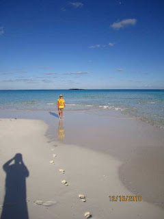
We motored at the recommended idle speed for about half an hour, winding this way and that, passing side channels too shallow for our motor. Following the chart, kept in a waterproof envelope, we rounded a turn which opened up to a view of the ocean on the other side of the island. Here was the “hidden” beach we had been promised. GRIN GRIN Man it was lovely. BTW the weather could not have been more cooperative. We frolicked in the surf which cast up on the beach from several directions creating fascinating ripples in the sand. The wind too carved the sand into marvelous sights, as the rays of the setting sun cast long shadows. Unknown sand dwellers carved hollow s in the strand which collapsed as we walked over them.
With a need to return to the mother-ship before dark, we returned to our beached ride. There we met the first humans we saw all day, a couple from Florida. The low traffic count helps keep the beaches looking pristine, but as we’ve seen elsewhere, flotsam winds up on beaches everywhere. Some caring soul had gathered up lost flip flops, tossed juice containers and tangles of fishnet line and left them on a rock for us to deliver to the Park Office. The park accepts no personal trash, but welcomes picked up litter. We got back to Bentaña as the sky turned its usual spectacular dusky colors and headed for a nap. The water was about 15 feet deep and we could clearly see the bottom. As I looked under the boat upon arrival, I saw a barracuda lurking in the shade cast by our hull.
 |
| Our little hitchhiker |
 |
| Our dink ride through the mangroves |
 |
| Attempting to pay the mooring fee |
 |
| Mangroves |
 |
| Who lives here? |
 |
| Exuma Sound (ocean) |
 |
| Exuma Banks end |
 |
| "Barry" the 'cuda |


No comments:
Post a Comment